Soil texture
Utilizing gamma radiation mapping is an exceptionally effective technique for analyzing the composition of soils. This brought us to a broad range of fields, ranging from mapping cropfields in spain to determining the clay content for hydrological purposes in dutch wetlands.

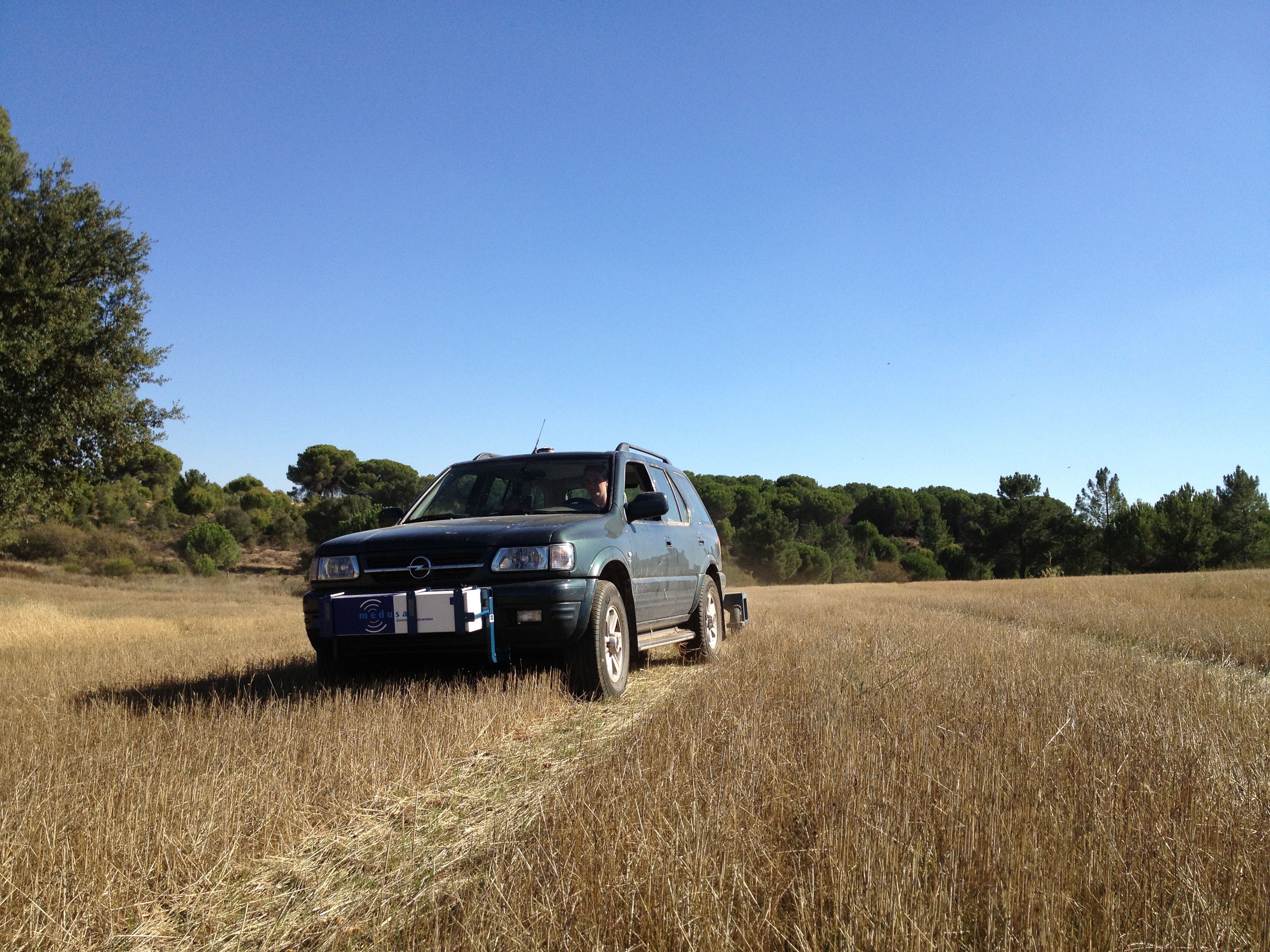
mapping the clay content of a cropfield in Spain
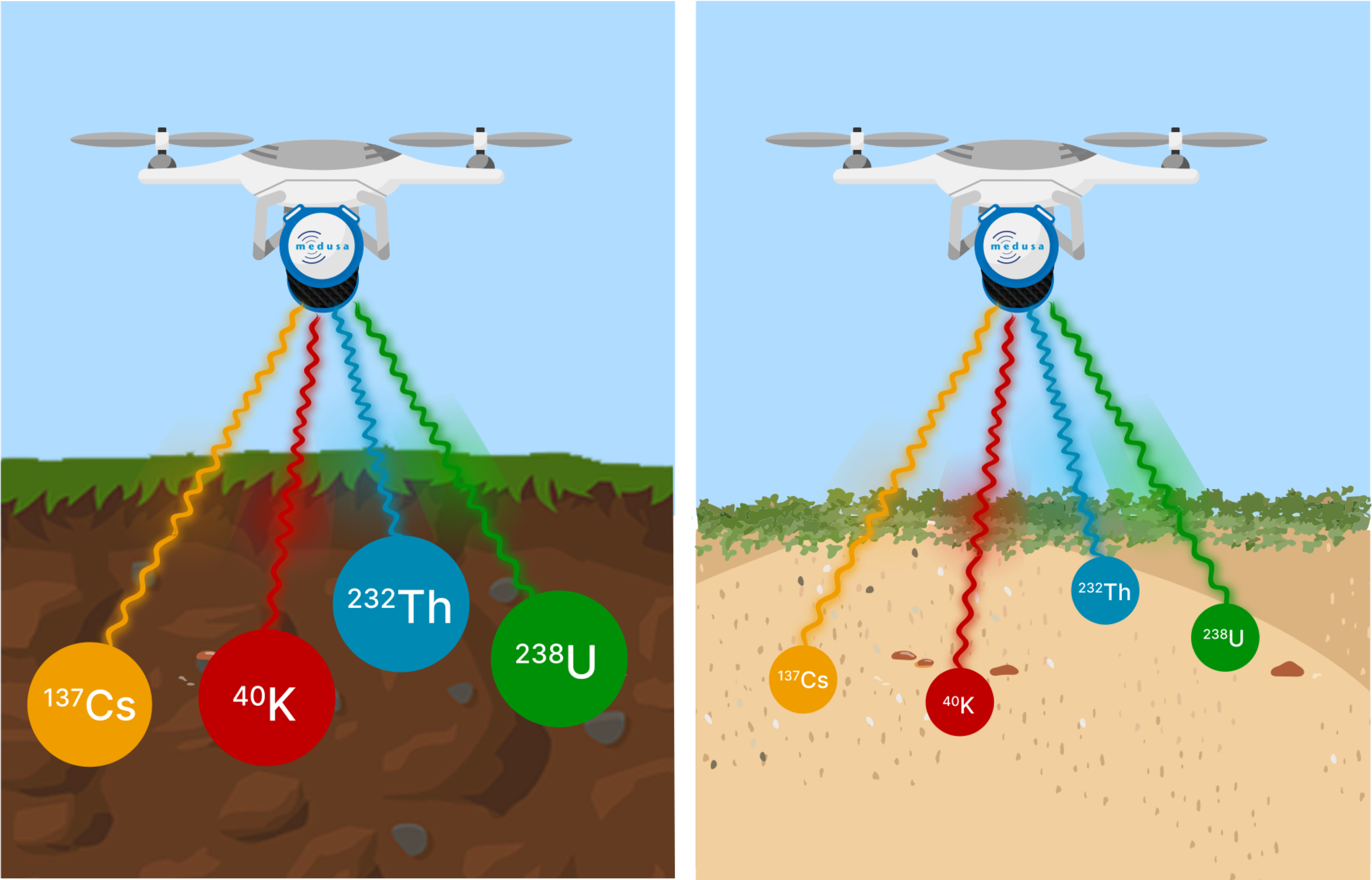
Radionuclides like 40K, 232Th, and 238U have been present in rocks and sediments since the Earth's formation. Soils typically consist of sand, clay, and organic materials. The varying chemical compositions of these components mean that the radionuclide content differs across different types of soils. The relationship between radionuclide levels and soil composition is determined through calibration processes conducted in a laboratory and is called the radiometric fingerprint.

The concentration of radionuclides in clay and sand is different.
The radiometric fingerprint of soils refers to the specific concentration of radionuclides (such as potassium (K), uranium (U), and thorium (Th)) present within each soil end-member. An end-member can be defined as a group of minerals with similar mineralogical and grain size properties. This fingerprint is determined by the composition and origin (provenance) of the end-member and is a constant for each mineral fraction.
These fingerprints are often derived by statistical models on sample analyses. Examples of these studies are presented with linear correlation ( Mapping clay content), by using vector machines (Proximal gamma-ray specrtometry for precision farming) or by applying machine learning in the mapping of clay content in vineyard soils: Mapping clay content in Vineyards.
Case studies:
Soil texture mapping for hydraulic properties
Soil physical conditions, including soil moisture, play a critical role in governing the interactions between biochemical and nutrient cycles, the biodegradation of toxic substances, and the regulation of greenhouse gas emissions from or absorption into the soil. These interactions are foundational to environmental functions and designs, highlighting the importance of a robust understanding of soil and its environmental interactions. Gaps in soil physics data and the need for updated information call for the application of proximal sensing techniques to efficiently and accurately collect soil physical properties, which are essential for refining soil hydraulic models and pedo-transfer functions that predict soil behavior based on key soil properties.
In a report on these proximal soil sensing techniques, by the University of Wageningen, a review is made of various studies on mapping soil properties by gamma-ray mapping. This report concludes: Reviewing these results, we can conclude that clay content in 0-30 cm depth can be predicted using γ-ray spectrometry with reasonable accuracies in multiple studies. In one study also the coarse sand fraction could be predicted. Other properties have either not been evaluated or returned lesser results in the papers reviewed here.
Since calibration of spectra to textural properties is provenance dependent, calibrations tend to be regionally stable. Therefore, once determined for a region, the calibration can be applied on-the-go to derive soil property information in real-time.
Better sampling of heavy-loamy soils
Dutch Wageningen University & Research has embraced the gamma-ray spectrometer approach to enhance the precision of field sampling, particularly in heavy-loamy soils. A preliminary site scan was conducted to aid in the planning of soil coring operations, focusing on the need for clay content information in these heavy-loamy soils. Utilizing the MS-2000 gamma-ray spectrometer, the team mapped the spatial distribution of radionuclides across the site. This mapping was crucial for identifying variations in soil composition before any coring took place. A regional calibration model, developed from datasets obtained in previous projects, facilitated the conversion of radionuclide measurements into accurate estimates of clay content. This preparatory step was essential for optimizing the coring strategy by pinpointing areas of interest based on their clay composition.
Following the coring process, a detailed comparison between the predicted and actual clay contents was performed to evaluate the accuracy of the pre-scan predictions. Remarkably, the predicted lutum (clay) concentrations exhibited a mere 0.5% deviation from the results obtained through laboratory analysis of the core samples. This high level of accuracy underscores the effectiveness of using gamma-ray spectrometry in conjunction with a regional calibration model for precise soil characterization. The successful application of this technology not only validated the initial pre-scan approach but also demonstrated its potential for enhancing soil research and sampling methodologies.
more information: Proximal sensing of clay
Cropfield mapping to improve water retention
In Spain's semi-arid northern regions, agricultural fields face challenges such as erosion, compaction, and low organic matter, leading to poor nutrient availability and water retention. This situation, exacerbated by low rainfall, results in unsustainable farming practices and low yields. The EU LIFE+ project 'Crops for better soil' aimed to address these issues through agronomic measures like organic farming, crop rotation, and the introduction of legumes and traditional crops suited to the local climate. Implemented across 300-400 hectares in various regions and involving 14-20 farmers, the project demonstrated significant improvements in soil quality and financial returns by adapting farming practices suited to the specific conditions of high-altitude, rainfed fields.
The project leveraged advanced soil sensing technologies, including gamma-ray spectrometry and Ground Penetrating Radar (GPR), mounted on a 4x4 vehicle equipped with an Agribox, to collect detailed soil data. This innovative approach allowed for the effective mapping of soil properties such as texture across the targeted fields. By combining soil sensing with traditional sampling and the analysis of open data, the project facilitated a deeper understanding of soil conditions, enabling farmers to recognize patterns in their fields and opening discussions on soil management strategies. This blend of technology and traditional knowledge not only enhanced soil understanding but also paved the way for more precise and sustainable farming practices in Spain's semi-arid regions.
More information is posted in our case study: Soil mapping for better crops
