
Soil mapping for better crops
Effective soil sensing system helps to better understand soil in Spain
On many rainfed, higher-altitude agricultural fields in the semi-arid regions in the north of Spain, soils are prone to erosion, compaction and low organic matter content. Therefore, these soils suffer from a low nutrient availability and water holding capacity. Together with low precipitation rates this results in low yields and unsustainable farming. The EU LIFE+ project ‘Crops for better soil’ was initiated to show that with several agronomic measures, the (financial) yields and the soils of these fields could be improved. The project demonstrated this approach on a significant scale by applying these measures on over 100 fields. Together these fields comprise 300 – 400 hectares, spread over the regions Castilla la Mancha (Guadalajara), Aragon, Navarra and Castilla y León (Zamora/Benavente) and these fields are owned by 14-20 different farmers. The agronomic measures include a conversion to organic farming, increasing crop rotation, introduction of leguminoses and introduction of traditional crop varieties that are better adapted to the cold semi-arid climate.
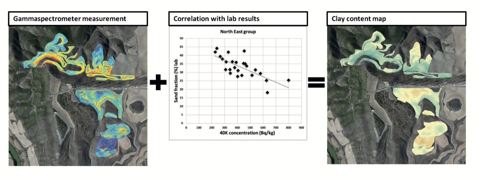
The measurements of the gammaspectrometer are correlated to lab results and presented as clay maps of the cropfields.
To assess which crops and which rotation are suitable for which field, and to assess improvement of the soil, a soil data acquisition and monitoring plan was designed. Soil and field properties to be assessed are soil texture, soil organic matter, tillage layer depth, compaction, altitude, slope and nutrient concentration. Because the aim was to acquire data on a large set of soil parameters with a good spatial coverage, a combination of traditional sampling and soil sensing was chosen. To facilitate this, Medusa Explorations and Medusa Radiometrics built a flexible and robust measurement setup on a 4x4 car: the Agribox. This Agribox consists of a gamma-ray spectrometer, a Ground Penetrating Radar (GPR), GPS and integrated logging software. All fields were scanned at the beginning and end of the project. At the beginning and at the end of the project all regions were sampled by Universidad Politécnica de Madrid (UPM). The acquired data was combined with open data from Instituto Geológico y Minero de España (IGME) and analysed on soil properties and soil status.
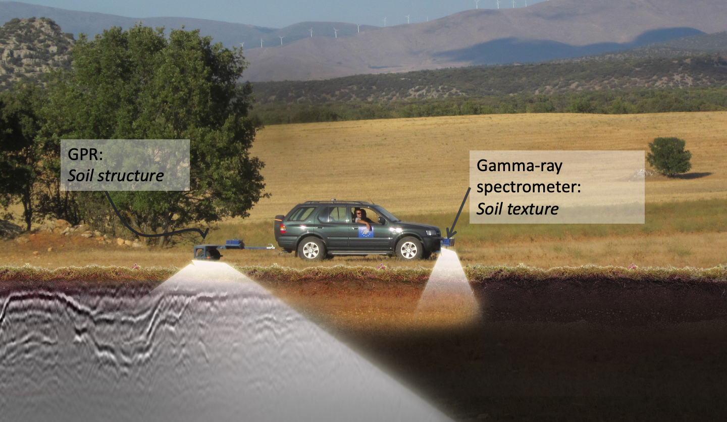
The set-up used, contained a MS-4000 gammaspectrometer and GPR. This proved proved to be a robust, effective and efficient soil sensing platform, mounted on a 4×4 car. The data acquired in the field provided a useful means of communication between measurement crew, agronomists and farmers.
Farmers recognize patterns in field
The farmers recognized the patterns in the fields as shown by the geophysical maps from their own experience in working with these fields for many years. This improved their support for soil sensing and improved the discussion between agronomists and farmers about the differences between and within their fields. By semi-quantifying and mapping the farmers’ experience soil sensing opens the door to a better understanding of their soils and perhaps the use of more advanced precision farming methods.
Combination of soil sensing, sampling and ancillary data
The combination of soil sensing, soil sampling, the use of ancillary open data and expert knowledge enabled the (semi-quantitative) derivation of many soil parameters including an indication of soil quality. The use of ancillary data was crucial for the correct interpretation of sensor data.
The results of the EU project are described in the poster and paper below.
Medusa_PosterA0_BarcelonaDEF.pdf
2016 Multi Sensor Soil Sensing Tool for Farmland in Spain.pdf