
Drone-borne gamma-ray
Pages below
Please also check the pages below this page for more in-depth examples of drone-borne gammaray surveying
Why going for unmanned aerial gammaray sensing?
There is a strong growth of interest in UAV-borne geophysical surveying. Not so much to replace “standard” airborne geophysics, but as a cost-effective replacement of land borne work. At Medusa we’ve been getting several inquiries by people and companies active in geophysics asking what the options are in using gammaray spectrometers on a UAV platform.
So far our answer has been the obvious counter-questions: “what payload do you have available and what application do you have in mind”. Simply, because from an instrumental point of view, one needs to know this to create the optimum instrument.
However, for several reasons, countering the enquiries has not helped “lift” UAV-borne gamma-ray off the ground (literary). So we decided to take another route and start building the gamma-ray sensor we think is right for the purpose of UAV-borne work. To do that we teamed with Mr. Jon Holst of Geoduster (Knysna, South Africa – www.geoduster.com), who has a long-standing expertise as a technology provider for airborne geophysics.
Our development
We have joined forces to develop a new series of rugged, low-weight detector systems, among other aimed at UAV applications. Our new sensor series is optimized to achieve the lowest possible system weight and power consumption, while maintaining maximum detector performance. We’ve done this by thoroughly assessing each component of a gammaray detector system. Amongst others:
- Using MCNP computer modelling to get the optimum size and shape of the sensor’s sensitive part (the scintillator crystal);
- Integrating power supply, high-voltage, readout, data processing, storage and I/O into a single low-power PCB board;
- Embedding data acquisition, viewing and processing all onto the embedded computer system;
- Using ultra-strong, lightweight materials for housing and connectors of the sensor.
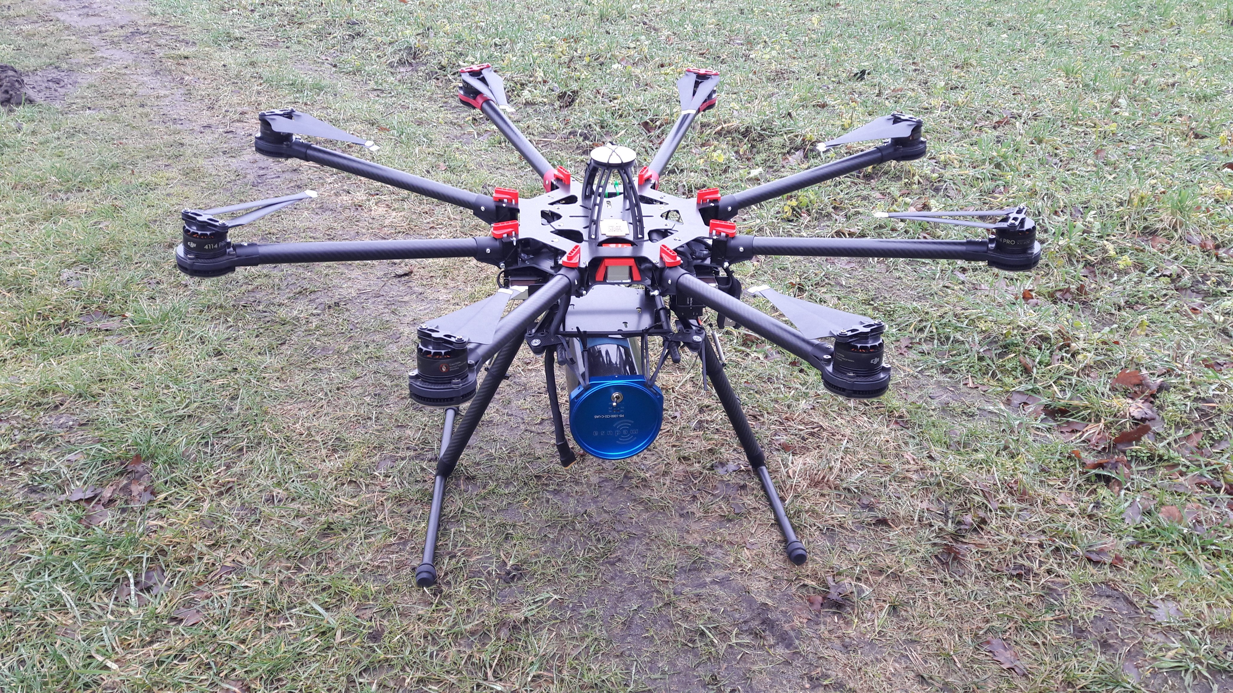
And we came up with a new series of sensors: the Medusa MS-UAS (Unmanned Airborne System) series of detectors. They consist of a 1-liter or 2 liter 3.5 inch diameter CsI crystal mounted inside a carbonfibre strengthened housing. Overall system weight for the MS-1000UAS is just below 7kg, the 2 liter MS-2000UAS weighs just below 11kg.
We strongly believe that with our new series of detectors we open the door to UAV-borne gammaray surveying. Our new series of gammaray sensors are fully self-contained and can flawlessly be used for autonomous monitoring and prospecting missions.
Check here for a flyer of the system
The proof of the pudding.....
is in the eating
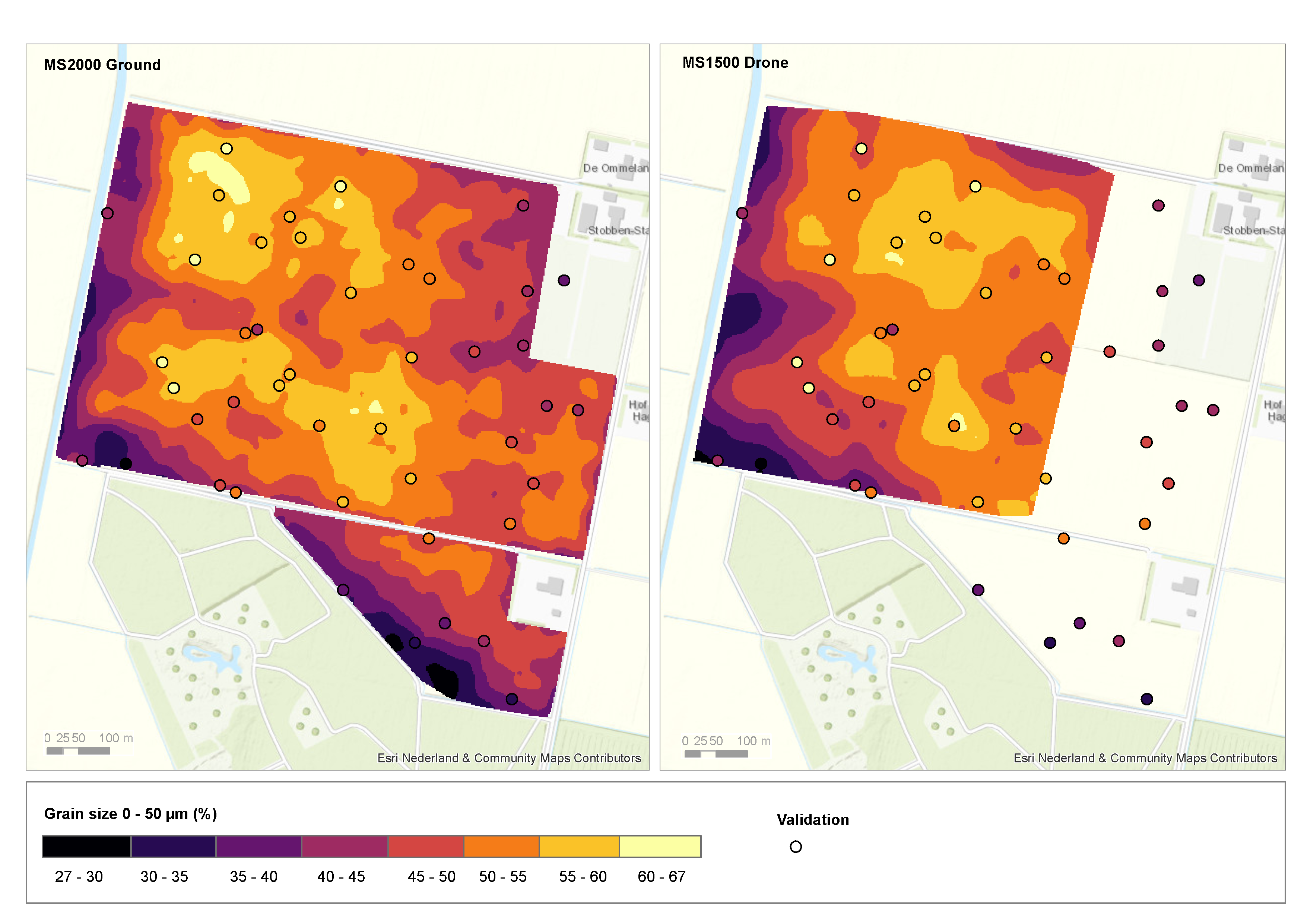
A new technological development is nice, but it only shows its value in a successful application. We mounted our system under a drone for mapping a crop-field located in the Netherlands. The project was conducted in collaboration with the university of Wageningen and Wageningen Environmental Research.
The measurements showed that the technology works and that the MS-UAS can be used for high quality mapping of the mineral composition of soils. The drone based survey yielded similar results as the ground borne measurements and both compare well to soil samples that were taken for validation.
Movie
Links
The measurements are presented in a Film: a new era in soil mapping and the results of the project were presented at the 2017 Pedometrics conference. The presentation on comparing UAV airborne and proximal measurements can be found here or in our downloadsection.
The results are published by Wageningen University and Research.