
Mine tailings
Risk assessment of mine tailings
Risk assessment of sites contaminated from mine tailings asks for objective and quantitative methods for site investigation. Small sites are often mapped by coring, sampling and successive laboratory analyses used for the assessment of chemical contaminants. For larger sites, sampling is virtually impossible because of time and costs involved whilst geophysical mapping systems give only a qualitative image of the site of study. This qualitative image is often not suitable for a quantitative risk assessment and decision making for local authorities.
In the project, a strategy was developed for quantitative, spatially-detailed mapping of zinc concentrations originating from mine tailings (zinc slags) distributed over an area of 2.600 km2. The results of this mapping allow for calculating direct risks related to health, risks related to leaching to groundwater, and as a result a ranking of the various sites in terms of priority for remediation.
De Kempen area, the Netherlands
The area “De Kempen” in the Netherlands and Belgium, was well known for its production of zinc from ore delivered from all places over the world. In the process of zinc production, zinc is removed from the ore and the remaining waste product is zinc slag. This zinc slag is light, and contains high concentrations of all types of heavy metals. Until the 1970’s these zinc slags were spread all over De Kempen in to improve public and private roads. The potential ecological risk of the heavy-metal containing asks for measures to remediate these zinc slags.
One of the major challenges in the pollution problem of zinc slag in “De Kempen” is in the estimated area of 2.600 km2, charged with heavy metals from the zinc industry. This large area is a potential hazard giving problems to ground water, or giving treats to human health. However, mapping this potential hazard by traditional sampling methods was impossible due to lack of financial resources and time involved. Given the size of the area, there is an apparent need for a rapid, synoptic method to locate the zinc slags. When information is available, public can be informed on risk involved and measures that will be taken. This study aimed at the development of a method by which the presence or absence of zinc slags in the roads of De Kempen can be quantified and verified. After the study, more than 1.200 km of roads where investigated.
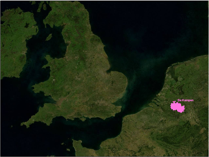
De Kempen area located in the Netherlands.
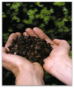
Zinc slag present in de Kempen area. This material was used as construction material in roads.
Quantification of zinc slag by radionuclides
The mineral composition of the ores in the mine tailing differ from the mineral composition of the normal soils in De Kempen area. As a consequence, the concentrations of natural occurring radionuclides also differed between the zinc slag and normal soil. From the area, 900 samples were taken and these samples were analyses on the concentration of zinc and the concentration of radionuclides.
This study showed irrefutably that a correlation exists between the concentration of radionuclides and zinc content: samples that contained zinc slags are also enriched in uranium, and the ratio between the uranium and thorium deviates from 1 (the background ratio found in “clean” samples). These radiation measurements are not only limited to laboratory situations but can be used to map the contaminant levels in the field.
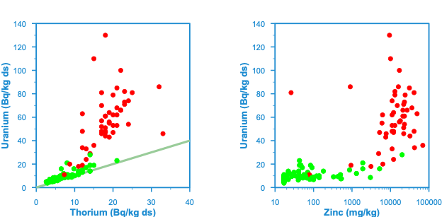
Scatterplots of uranium vs thorium and uranium vs zinc for samples that visually contain zinc slag (red dots) and samples that visually do not contain zinc slag.
The concentration of radionuclides were measured with a MS-4000 gamma-ray spectrometer mounted on a car. The measurements were stored in a GIS database and data were interpreted and classified in sections with 3 classes:
- Zinc slags are below detection limit (and where zinc slag is probably not present )
Zinc slag is heterogeneously present (with an average concentration of zins slag for the section of road)
Zinc slag is homogeneously present
Within these zones, samples were taken that were used for validation. In total 1.472 corings were taken and 8.697 samples were measured on its concentration of zinc by hand-held XRF systems. These results were compared with the outcome of geophysics. This shows a correspondence between the measurements over 90%, with only 5% of the blues being a false negative and only 8% of the values being a false positive. The GIS based database of contaminant levels was used for policy making and defining a remediation strategy.
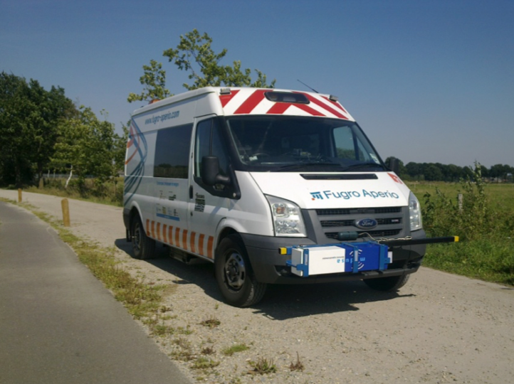
An MS-4000 mounted on a vehicle allowed for continuous mapping of the concentration of radionuclides.
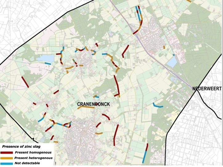
Map showing the presence of zinc slag in roads.
Conclusions and further reading
The project showed how geophysical mapping methods can be used to derive quantitative information on the distribution of heavy metal contamination in a large area. The approach of combining the geochemical measurement of a gamma-ray spectrometer and ‘traditional’ corings shows that the results are up to par with an approach of ‘traditional’ sampling but at a much lower cost.
The uniqueness of the project is though not only in the technical part of geophysics, but also in the use of the information. The outcome of the mapping has been used to determine risks on human health and risks for leaching at high spatial scales. This detailed investigation helps the government to prioritize remediation actions and gives society direct information on the risks involved.
More reading in our white paper.
A film shows the approach of mapping and use of the data.
With a similar approach, contaminant levels of dioxins were mapped in a floodplain.