

Geology and mineral exploration
Radiometrics has been used for geological mapping and exploration since the early days of geophysics. Often, large scale regional surveys are conducted by mounting a gamma-ray spectrometer in a plane and flying over the area in a grid at altitudes of about 80m elevation. Often, a gamma-ray spectrometer is part of a suite of geophysical methods that are mounted in an aircraft.
Geological mapping
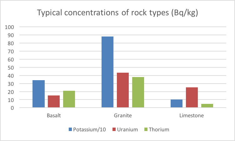
Changes in lithology (rock type, provenance) are often accompanied by changes in the concentrations of the natural occurring radionuclides. The maps of the radionuclides can therefore be used as a good indicator of geological variations in the field and help a geologist to set up a detailed geological investigation.
Mineral exploration
Many mineral deposits have specific radiometric signatures. Hydrothermal ore deposits are often associated with potassium alteration (a mineral alteration is a change in the composition of the mineral) and ores containing uranium or thorium can be measured directly.